Andy Hunt provides a look into a Covid-secure creative twist on the traditional diving expedition, and in the process learned much about shore diving around his home on the Isle of Wight.
This time last year I was planning this year’s BSAC Expedition Scheme plans and dovetailing them into my own diving plans. At the tail end of 2019, they were announced at the BSAC Diving Conference and we started to deliver on them with the Advanced Diver training expedition up the Sound of Mull before lockdown arrived.
In the context of challenges people are now facing, a temporary pause, albeit a long one, in our diving plans is not really that important in the grand scheme of things. I have very much appreciated the efforts of full-time staff and volunteers to give us the guidance to get things going within the government's guidelines and for members of my branch to work within the present Covid-19 constraints to come up with what essentially are everyday expeditions in our own back yard.
According to my original plan, I should have just finished running a First Class Diver Exam / Expedition off the Cornish Coast at the beginning of June, but at the time of writing Cornwall was still closed. The following week I should have been diving the Scilly Isles, having secured a rare place on a hard boat ages ago; but the Scilly Isles were also still closed.
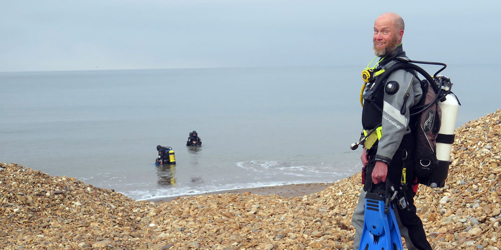
Instead, I found myself on my home island of the Isle of Wight wondering what to do with a week’s holiday (now staycation). Fortunately, some members of my local club Wight Dolphins came to the rescue with the Big Dive Week. Even this was a Plan B because the week in question normally sees the club RIB relocating from its normal home at Yarmouth on the west of the island to Bembridge Harbour on the east of the island for a week of intensive diving sites not normally visited by the club.
Changing plans, the Dolphins’ Chair Chris Marsh and Training Officer Simon Curliss led the charge to shore dive a combination of the usual sites and also to re-discover sites that probably have not been shore dived for years.
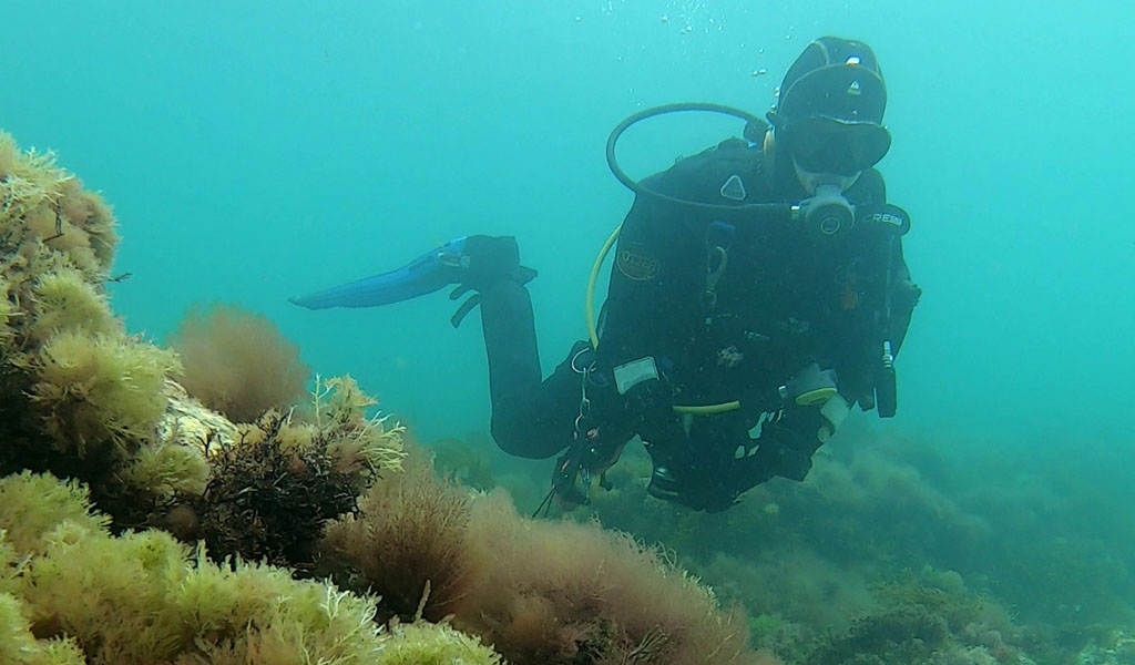
The dives had to be Covid 19-secure so that meant aligning with both government guidance and also implementing the recommendations issued by BSAC, the governing body for the sport in the UK. Most recommendations are common sense. For example, if you feel ill – isolate and don’t dive. Turn up with your kit pre-assembled, checked and ready to go rather than assembling it on arrival to find out you have a problem. Travel independently to the site. Buddy check at 2m distance. Build up dives progressively even on shore dives!
Risk assessments and emergency plans are more important than usual under current circumstances. Clearly, we should avoid experiencing an issue in the first place; then if something does go amiss you should have a plan to deal with it in as Covid-safe a way as possible.
So, onto the dives...
Bembridge lifeboat slip and ‘Old Poo Pipe’
There are a couple of dives here. The obvious one is the Bembridge lifeboat pier and slipway, which extends out about 150m out into the Solent from the shoreline. Care is needed not to dive in front of the lifeboat slipway – rogue divers in the past have caused RNLI crews concerns, but thankfully most divers are responsible. Depths are shallow – up to 3-4m – and the tide can run pretty quick along the beach perpendicular to the pier (NW/SE direction). Eelgrass lies off to the side and close in.
There is an underwater tunnel underneath the RNLI boathouse foundations, which a single diver can enter if they are that way inclined as the grill preventing access has fallen away on one side. It is still in place on the other side, so you need to go out the same way you went in. There isn’t that much to see in the tunnel, but it does serve as a waypoint to tell you that you are very close to the slipway and should be turning back to avoid its boat traffic.
Just to the south-east, there are a couple of old outfall pipes. It is the most southern one that provides the better dive. You can make out the outside of both the pipes on Google Maps. On low water spring tides, you can see the pipes exposed (or at least buried under weed) but we tend to dive here at high water slack.
The dive tends to start at the first of two beacons marking the pipe. You wade out to the first one along the concrete covering the pipe, staying on track by keeping both the beacons in transit. You then dive underwater and follow the pipe out the end, where the seabed drops to about 6m before turning around and following the pipe back. There is plenty of life in and around the pipe – sponges, anemones, lobster, crab, native oyster, and the very occasional scallop. Scallops are rare here, so please leave them be.
Totland Pier and Bay
This site provided the opportunity to do both a known dive (Totland Pier) and an ‘unknown’ exploratory dive off the old lifeboat slipway at the opposite side of the bay to the pier.
Totland Bay Pier is perhaps the island’s most dived shore dive site. Access is easy, the visibility is usually good, there is plenty of life under the old pier given most of the surrounding seabed is sand and the pier is the only thing sticking out of the seabed. Logistics are easy – you can usually park very close to the entry point, the toilets are nearby, there is a cafe and generally, as it is a bit more tucked away the site is quiet.
The concrete sea defence revetment to the east of the pier provides a handy place to kit-up independently without assistance from your buddy and the walk to the water is short (with your buddy at a suitable distance). Depths are up to 6m at the end of the pier, where you do need to be mindful of the tides, though they are generally manageable. Like most island shore dives, diving high water slack is the best time, which at this site is approximately two hours before HW Portsmouth. Another new risk to manage for us at the moment is being hit by any objects that workmen may drop from above while they are rebuilding the old structure.
The ‘new’ site for us was the Old Lifeboat station. This does involve a five-minute walk, but fortunately, that is along a flat, concrete revetment from the car park in front of the flats, rather than across a shingle beach. Steps on the old lifeboat slipway provide an easy way into the water and weren’t too slippery but if it does get a bit too slippery then there are some wooden steps down to the beach on the other side.
We simply took a bearing out to sea, crossing zones of sand and rock. The area is frequented by visiting pleasure boats in the summer months, so it wasn’t particularly unexpected to come across a few lost anchors. There were some older, more unusual metal objects which appeared to be old mooring clump weights. As we neared the shore on the return, masked crabs appeared in our path and tried to avoid us.
Fort Victoria Pier
This is another dilapidated island pier but much shorter than the others. It is situated just east of Fort Victoria, with its usually ample parking. The shingle beach drops off quickly to a gravelly bottom at 6m, with the pier being subjected to quick strong tides.
The tides are a little odd here, with the flood tide being deflected by the promontory on which the old Victorian Fort sits to form a back eddy. You can look out at the Sconce North Cardinal Buoy to see a wake breaking around the waterline on the flood tide going east, only to throw in a piece of driftwood off the beach to see it head west at a much more leisurely pace.
The tides are so fierce just offshore that the site was chosen to deploy a prototype tidal turbine in 2015 called PLAT-O; a key reason why I moved to on the Isle of Wight, as I was the Engineering Manager for the company that deployed it!
The site is best dived at ‘slack’ although a little bit of tide does make it a little more interesting and a helps clear any silt you may disturb from the site. We’re usually on a nudibranch hunt when we dive Fort Victoria Pier.
Grange Chine
This is definitely not on the beaten shore dive track, for reasons that will become apparent. You park at the side of the busy military road (watch out for speeding traffic) and access the beach after a 200m walk down the hill on the public footpath through Grange Farm Caravan site.
Our target and mission were to try to swim out to Chilton Calf rocks 400 yards offshore to the west and locate the wreckage of the steamship Woodham, which sank in 1873 having broken down and drifted onto the rocks.
We didn’t find any iron wreckage but did come across some bits of coal, so we probably weren’t too far away. On the way back we found the occasional sunken piece of wood that looked a bit too straight to be a tree trunk but could perhaps be an old ship’s mast.
The seabed here is a mix of flat sand interspersed with rocky outcrops and some reasonable gulleys closer to the Chilton Calf Rocks. As we dived around high water, we were blessed with good visibility here once past the first 50m next to the shore, which was brown. Again you need to watch the tides here; we had a barely perceptive tide behind us on the way out, that become more noticeable on the way back. After a fairly long dive, you then need to walk back up the hill. The worse bit is the shingly beach and the first 50m up the hill.
We managed to get about 6-8m of viz at the further point. This dive required a bit more planning and some endurance. The walk to the water will put a lot of people off whose fitness levels aren’t up to task, but for those of us who did do this it was a great little dive with a sense of adventure and exploration.
Site of the Ventnor Pier
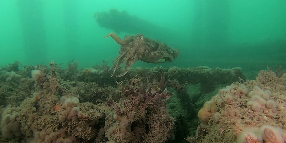
One of our club members who lives in Ventnor had been keeping the club informed of the state of the visibility. It went from milky, to good to positively Mediterranean. Normally the visibility is around 3-4m. However, when we dived it as you can see from the photographs in this article, the visibility – for Ventnor – was stunning.
When Dive Wight and Hampshire was penned by Martin Pritchard (who still lives and dives off of the island) and the late Kendall McDonald (former BSAC Chairman and BSAC stalwart), Ventnor Royal Victoria Pier still existed, albeit in a state of decay with some fire damage and the near harbour works and outfall pipe did not exist.
I have found great inspiration in some of the old dive guides from the 80s, particularly the Gordon Ridley series around Scotland. Their basic sketches and descriptions of sites have lured divers on many expeditions, and it proved the same with Martin and Kendall’s description of this site in the 1980s, which describes dive site ‘137. Ventnor’ and ‘138. Chancellor’.
Based on this write-up, I learned some facts about the area: First, St Boniface Down is 236m above seawater and, second, in the 80s, Ventnor had a population of 7,000 in winter, doubling in summer.
More importantly, underwater I learned there were some rocks to the east of the pier (called The Bean), around which there are bits of old wreckage. Also, a paddle steamer called the Chancellor was wrecked by the pier in 1863. Thirty-four years later we set out to dive the same geographic location. As lockdown eased, the population of Ventnor was still largely in the routine of staying at home with limited exercise outside, perhaps a walk along the largely deserted promenade or up the hill onto St Boniface Down.
Unfortunately, the pier was demolished in the early 1990s (although almost resulting in a salvage barge being wrecked) and a harbour constructed from tonnes of rock armour boulders, buries the site of the wreck of the Chancellor and part of the pier.
For those of us that set out to discover whether the reports of visibility were true, we were not to be disappointed. We found substantial chunks of pier legs, cut off just above the seabed, a large old Danforth-style ship’s anchor, a small gulley full of old fishing weights from when people used to fish off the pier and a very bold and large lobster, clearly not afraid of divers.
We also discovered that slack arrives earlier here than expected. After clinging onto bits of the pier in the tide, we managed to get to about 8m depth but most of the dive was around 6-8m.
We returned the next day, having done more research into the site, looking at old photographs and relating it to the modern-day buildings for another great dive but this time a little earlier to avoid the worst of the tide.
Yarmouth Pier
Yarmouth Pier is a well-maintained pier that would normally be considered ‘off-limits’ for diving. The busy Yarmouth/Lymington ferry docks only a few tens of metres away and the harbour entrance is normally crowded with yachts and well-heeled gin palaces going in and out. You also need formal permission from the harbourmaster to dive in the harbour and the paperwork alone will put most divers off. However, when we dived, lockdown measures were still in force so the ferry wasn’t running and boat traffic was limited to the occasional boat.
The paperwork proved easy to navigate especially once the harbour authorities understood we were not at work and following the rules of BSAC, the national governing body for the sport in the UK and with £10,000,000 third party liability insurance. The dive permit is however still aimed at commercial divers but we managed to complete it using our language rather than commercial language. Instead of following a ‘HSE ACOP' we followed ‘BSAC Safe Diving’; we provided a ‘Method Statement’ in the form of a written ‘Dive Plan’ and ensured there was a ‘Dive Supervisor’ in the form of a ‘Dive Manager’ and a ‘Risk Assessment’ in the form of a... ‘Risk Assessment’.
In practical terms, it meant running a shore dive properly, with a shore party ready to intervene to help if required (suited, booted, mask, snorkel, fins at the ready). We flew an A-flag from the pier in a prominent position and ensured the divers stayed under the pier and in communications with the harbourmaster.
Most of the plan went well apart from the tides. We planned to dive off slack on the tail end of flood, with the tide heading east away from the shipping. Unfortunately, what we learnt was that the tide turns quite quickly and earlier than expected, so those in the second wave of divers had to fin a bit harder than expected. We deployed shore cover on the pier, just in case.
Anyway, the dive overall went well. Lots of oysters, eelgrass, sponges, shoals of bass with depths down to 4m and tide picking up to 1 knot.
We also picked up a couple of potential new club members who had got wind of our dive and simply turned up. We gently pointed out the rules (harbour rules and Covid), briefed them and managed their dive as well, so our total group numbers were less than six on the surface and everyone had a good dive.
In summary...
I can honestly say that I thoroughly enjoyed a week’s shore diving and looking again at often overlooked local sites. We were very blessed with some excellent conditions for the Isle of Wight. We learned something about each of the sites, in particular, more precise timing was required.
It was also very cheap! The cheapest dive holiday I have been on for a long time and the first diving ‘staycation’ ever!
We got through half a tank of fuel driving around the island, fed some parking meters (remotely via the app) and indulged in the luxury / risk of a couple of takeaway coffees. I think the most I spent in one day was on a takeaway cream tea from one of the few cafés still open in a Covid secure manner. They almost looked surprised to have customers!
As Covid guidelines ease (region permitting), can I suggest you take another look at some of the humble shore dives? Maybe there are some easy everyday expeditions, adventures and explorations for your branch to undertake, whether nearby or further afield.
Join the BSAC community
The BSAC network is working together to keep people connected to the sport. With online training, special interest webinars, competitions, support to clubs and the trade, and much more...we'd love you to join us.
This Learning Curve was originally published in SCUBA magazine, Issue 106 September 2020. For more membership benefits, visit bsac.com/benefits.
Images in this online version may have been substituted from the original images in SCUBA magazine due to usage rights.


